In England, in the summer floods of 2007, around 55,000 properties were flooded and nearly 500,000 people were left without water or electricity. After this, whole-catchment responses to flood management were required, including changes to upland land use.
Whole-catchment responses were prompted by the Pitt Review: Lessons learned from the 2007 floods, commissioned by the government.
As a result of this, and as a response to the climate and ecological emergency, natural approaches to flood management have been gaining traction. They are known variously as:
- Natural Flood Management (NFM)
- Nature-Based Solutions (NBS)
- Working with Natural Processes (WWNP).
Managing floods naturally
Natural flood management can be generally defined as using natural materials, techniques and processes to slow the flow of water and lessen flooding downstream. It often has additional ecological and amenity benefits.
Examples include:
- in-channel techniques such as leaky barriers
- floodplain/riparian techniques such as ephemeral storage depressions and floodplain woodland planting
- headland techniques such as runoff-pathway management and peat restoration.
NFM has been installed and observed in a number of projects across the UK, undertaken by environmental regulators and government.
There are two main evidence types from which the effects of NFM can be examined in this evolving area of study.
- Empirical studies with observed data, such as the Environment Agency (EA) WWNP evidence base.
- Modelling or projection studies that model what-if situations to the best of our current understanding, using tools such as hydrologic and hydraulic modelling.
WHS has used both approaches and both can be used to complement each other.
WHS experience
WHS has been undertaking NFM studies for government clients since 2014.
We have developed an integrated catchment approach which has evolved from:
- modelling hydrological response to land-use changes
- catchment-wide hydraulic modelling to capture the effects of built NFM.
The Clwyd river catchment, north Wales
Our NFM journey started here. In this project we linked land-use characteristics to modelled river flows using a 2D hydrological model that we developed with the EA.
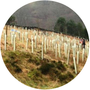
We modeled altered run-off properties across the catchment, accounting for changes to land use and management such as:
- tree planting
- re-wilding arable fields
- blocking field drains.
Scaling the results of plot-scale experiments up to catchment scale, we showed that NFM measures had significant potential to reduce the large summer peak flows observed in the catchment.
The Rhondda Cynon Taff catchment, south Wales
Our most advanced catchment-NFM modelling process was developed during this peat restoration and NFM hydraulic modelling study.
Again, the 2D hydrological model was used, and before modelling we identified areas with potential for NFM measures using a site-suitability analysis. This time changes in land use were related to changes in the rainfall-runoff model ReFH, which was in turn used to force hydraulic modelling of built NFM structures.
The three NFM techniques examined were:
- leaky barriers
- offline ephemeral storage areas
- runoff pathway management bunds.
Running simulations of group effects and individual NFM measures enabled us to identify the most effective NFM measures as well as maximum impact across the catchment. Our study showed that NFM did slow flow at the catchment scale.
EA literature does note that due to the relative infancy of NFM in comparison to other flood management techniques, studies can be improved by flow monitoring. This monitoring will be undertaken before and after NFM installation at WHS-identified sites.
The Llangefni river catchment, north Wales
We examined the headlands of this catchment using the same site-suitability analysis method. We considered a wider range of NFM measures, adding to the previous three:
- floodplain woodland
- river re-meandering.
Our study provided a nuanced catchment-wide assessment of areas with potential for NFM measures, using soil properties alongside existing spatial data sets such as forest cover, available land and installation constraints.
This project is currently pending next steps, including hydraulic catchment modelling to assess areas in which to install NFM.
The last word
It is promising to see nature-based and aquatic-ecology-compatible techniques being explored by government, as the ecological and climate emergency of the Anthropocene continues.
While we are still in the early days of this branch of flood management, projects across the UK and their observations will help inform improved NFM strategies going forwards.
This will allow for a more integrated approach to catchment flood management with benefits beyond flood risk alone.