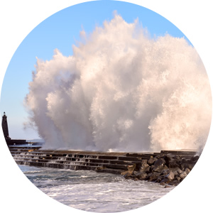
Managing the risk of coastal flooding is a hugely complex challenge. Greater statistical analysis is needed to guide design standards for defences.

A sea of troubles
Communities have made their homes in coastal locations around the UK for centuries. They live with a constant threat of coastal flooding and the risk of significant damage to property and infrastructure.
Coastal flooding often originates from extreme weather at sea, which can result in large waves and surges in water level. When storm conditions coincide with high tides and/or high river discharges coastal flooding is made far worse. Rises in mean sea level due to climate change would increase these impacts further.
Uncertainty is added to this complexity because of:
- the lack of historic records
- inaccuracies in estimation and modelling techniques
- changes in foreshore and beach profiles over time
- climate change impacts
- the potential for existing flood defence infrastructure to fail.
Significant analysis is required to understand the risks at any given location.
Understanding the problem of a locality step by step
- Offshore analysis – Studying historic events and backtesting (hindcasting) models with known data to increase understanding of the locality’s offshore sea-state.
- Offshore to near-shore wave transformation modelling – Hindcast data from offshore wave models is typically only valid for water deeper than 15m, so offshore wave conditions need to be transposed to near-shore conditions using a mathematical wave simulator such as SWAN (Simulating Waves Nearshore).
- Wave overtopping analysis – Estimating the overtopping rate of the defence. There are several possible methods for this. Each of the methods have their pros and cons and no method in isolation will give a universally ‘best’ fit.
- Inundation modelling – Identifying the spreading of flood waters from the crest of the defence to the people and property at risk, using appropriate hydrodynamic modelling software such as TuFLOW.
Available guidance
Historically, relatively limited information has been available for assessing coastal flood risk, but there are three documents which provide importance guidance.
- Investigating coastal flood forecasting [Good practice framework. Report: SC140007] This recent EA document sets out the steps to assess the coastal flood risk to a particular area, but crucially doesn’t describe the detail of each step. Lack of detail is partly because there is no ‘one size fits all’ method and any assessment method used needs to be tailored to suit the level of detail required.
- Coastal flooding assessment guidance [CH2M on behalf of the EA (2016) Standards for modelling and forecasting flooding on open coasts] This sets out the standards for coastal flooding assessments and is a very good source for identifying the level of detail expected for different types of assessment.
- The EuroTop manual This has very detailed information on how to calculate overtopping rates for defences and each modelling software program comes with its own guidance documents.
Possibly the greatest uncertainty with coastal flooding is estimating the overtopping rate for a given return period.
The available guidance provides plenty of detail on how to transpose offshore wave conditions to an overtopping rate, but there is very little guidance on the statistical analysis of different wave conditions.
This is completely different to the statistical analysis of extreme river flows, where the methodologies for statistical analysis are well documented in the Flood Estimation Handbook (FEH).
The last word
The EA has been pushing for a consistent set of coastal flood risk assessment standards in recent years. It is good to see guidance documents that clearly set out the assessment process and level of detail required at each step.
However, there is still a lot of uncertainty in identifying overtopping rates when it comes to assessing a design standard of coastal defences. We need to be guided by greater statistical analysis.
Going forward it would be good to see a comprehensive document detailing methods of statistical analysis, similar to the EuroTop manual for assessing overtopping rates of defences or the FEH for assessing peak river flows.