 The world’s oceans are rising.
Sea-level rise brings greater coastal flood risk and coastal erosion. Coastal properties, livelihoods and infrastructure are all threatened.
Since 1990, the global mean sea level has risen 20 cm because of:
- meltwater from ice sheets and glaciers
- the water volume increasing as the sea’s temperature rises.
During extreme storm tides (when sea level, tide and storm surge come together) coastal property, industry and infrastructure is at particular risk. Local factors such as topography, the height of flood defences and sewer capacities can worsen the picture further.
The Coastal Flood Boundaries Project
In the UK, the Coastal Flood Boundaries Project (CFB) provides critical data to guide strategies in coastal areas.
First published in 2011, the CFB dataset is currently due for an updated release using the latest science and tide-level data.
The CFB dataset provides data on extreme sea levels (ESLs) and extreme swell wave conditions along the English, Welsh and Scottish coastlines.
The ESLs were interpolated between primary tide gauge sites, supplemented with model outputs from the National Oceanography Centre operational continental shelf tide-surge (CSX3) model at 12-km resolution. A higher resolution model was used to provide ESLs for the complex coastline in the north-east Irish Sea.
The model outputs were corrected to ensure:
- there was good agreement between results at primary tide gauge locations and values obtained through statistical analysis of the tide gauge records
- there was consistency between results at intermediate nodes and the corrections applied at primary locations
- the data between the model nodes were linearly interpolated to provide return period sea-level values every 2 km along the coastline.
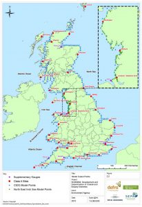
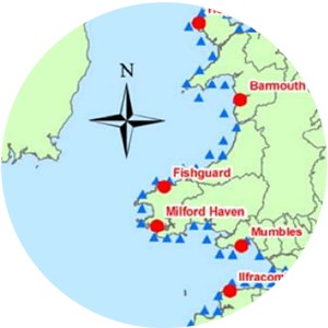
Model location points for the CFB dataset
The CFB update coming shortly includes these key partners, under the umbrella of the United Kingdom Coastal Flood Forecasting (UKCFF) group:
- the Environment Agency (EA)
- Natural Resources Wales (NRW)
- the Scottish Environment Protection Agency (SEPA)
- Department for Infrastructure in Northern Ireland (DfI).
A glimpse into the future for Welsh coasts
Sea-level rises and predicted increases in storminess will increase the risks of coastal flooding in Wales as elsewhere. This is particularly significant, since the majority of large Welsh towns and cities are located on the coastal fringe.
“… consideration must be given to the impacts climate change may have on developments in areas at risk of flooding over the lifetime of the development”
Technical Advice Note 15: Development and flood risk, Welsh Government 2004
The Welsh Government, in line with TAN 15 above, has provided guidance based on epochs of mean sea-level rises, using 2008 levels as a baseline. All developments must be resilient to predicted sea-level changes over their design life. This guidance is for mean sea levels only, not extreme wave heights.
It is vitally important that a strategy for future adaptation of coastal defences and beach management is developed.
Adaptation measures not only help to reduce flood risk, they also reduce exposure by limiting development in flood-prone areas, and reduce vulnerability through improved flood forecasting and warning.
Future sea-level rise will lead to a significant increase in wave overtopping and defence failure if we do nothing. But if we continue raising flood walls, we will disconnect coastal communities and vital tourists from the sea. We need a mix of solutions, including beach management, flood warning, increased property resilience and emergency response.
A role for WHS
WHS and HR Wallingford are currently collaborating on a project under the National Procurement Service Framework to produce an Outline Business Case in accordance with Welsh Government guidelines and identify preferred options for the management of a 11km section of Conwy coastline from Llanddulas to Kinmel Bay in North Wales.
This project will use CFB data to help quantify extreme sea levels along this stretch of coastline. This will then inform coastal inundation modelling and a damage assessment for a variety of scenarios.
The last word
WHS has undertaken numerous UK coastal flood modelling assessments using current best-practice methodologies.