 New guidance from the Environment Agency requires all new development and local plans to take increased flood risk into account, due to climate change, and to demonstrate how the risk will be managed.
Published in February 2016, the guidance is based on the most recent climate-change projections for the UK (UKCP09). It updates previous climate-change allowances to support the National Planning Policy Framework (NPPF).
Updates to hydraulic models, flood studies and flood strategies (including emerging Local Plans and SFRAs) must all account for the greater perceived risk in the future.
What is new in the guidance for climate change?
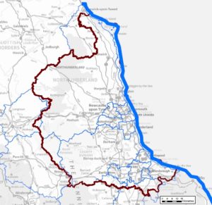
Peak river flows, peak rainfall intensity, sea level and offshore wind speed allowances are all covered. The biggest change is in the allowances for peak river flows. The guidelines now reflect how climate change will impact different types of catchment by covering different river-basin districts separately. Upper allowances vary from a 45% increase in river flood flows in the North East to 105% in the South East.
Current climate change guidance in Scotland and Wales remains the same, with a general 20% increase applied to peak river flows to account for climate change. However, it is anticipated that this guidance will be updated in the near future.
At a glance, changes in order of significance for England are:
River flow
The range of climate change allowances are related to the River Basin District Maps and predictions have increased significantly.
The new allowance for increase in river flows is as high as 105%. This could have a huge impact on flood levels. Any ‘more vulnerable’ development, ie. in Flood Zone 3a (high probability of river flooding), would need to use the higher and upper end allowances over the next 100 years. The increased risk of flooding would have significant implications for these developments.
Rainfall
Previously a 30% increase in peak rainfall intensity was applied across all of England for ‘more vulnerable’ residential development (100-year lifetime).
The new allowance for increase in peak rainfall intensity is as high as 40%. Flood Risk Assessments (FRA) are now required to assess both the central and upper-end allowances to understand the range of potential impact.
Sea level
A single regional allowance is still used for sea level rise in each timeframe.
The new allowance for sea-level rise is 1.24 m in the South and East and 1.02 m in the North West and North East. Both of these are over the next 100 years.
What do the changes mean for development?
Some of the allowances are onerous for new development and design.
The possible consequences to development of the increased river-flow risk include:
- increased extent of floodplain
- increased height of finished floor levels of buildings
- increased areas for flood compensation and drainage
- reduced net developable area and site viability
The changes in peak rainfall intensity are not considered to be all that significant and should be manageable.
Surface-water drainage strategies could be affected and designs may need to incorporate larger soakaways or storage ponds/tanks to hold greater volumes of water.
We understand that when consulted on reserved matters for site applications that have outline planning consent pre-dating the new climate change allowances, the EA will respect any parameters set by the conditions attached to the outline consent.
This means:
- If a planning condition specifies a specific increase in risk to account for the impacts of climate change, the proposed drainage system can to be designed to this specification.
- If a planning condition refers to a more generic risk to account for the impacts of climate change, the EA will probably request that the system is designed to the new 40% allowance.
The last word
The application of the updated guidance is still relatively new and allows room for interpretation.
It is essential to engage in pre-application discussions with bodies responsible for advising and dealing with all aspects of flood risk and flood risk mitigation, including the EA and relevant lead local flood authorities.
Establish the design criterion early on in the development process to minimise delays.
Look for planning conditions which prescribe specified rainfall intensity in particular.