An eye for detail. Enabling development expansion.
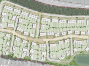 Flood map data for the flood zone of a minor watercourse in Nottinghamshire restricts the number of properties in a planned 87-unit housing development.
Flood map data used for planning purposes is sometimes based on coarse modelling techniques that can …
 Several years of modelling analysis and negotiation with …
 A plan to raise the access road was strongly opposed by the Environment Agency (EA) …
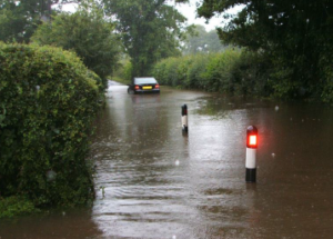 Planning conditions for development included: