Wales leads the way with SuDS

Wales has taken steps to implement Schedule 3 of the Flood and Water Management Act (FWMA 2010).
This is likely to have a big impact on developments and the planning process in Wales.
The journey to here
SuDS on new …
Wales has taken steps to implement Schedule 3 of the Flood and Water Management Act (FWMA 2010).
This is likely to have a big impact on developments and the planning process in Wales.
SuDS on new …
The Government prioritised affordable housebuilding in the 2017 Autumn budget. Make no mistake, this will not be at the expense of water management and pollution prevention.
The first action listed by the Chancellor was:
“Support more housebuilding, raising housing supply …
Issued: June 2017
Successful site development is dependent on drainage. Step by step, a number of things must be borne in mind.
Identifying the discharge points for both foul and surface water leaving a site is essential in …
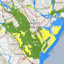 A victory for common sense with flood mapping in Wales
The Welsh Development Advice Map is to come alive. In April 2017 it is due to be aligned with the Natural Resources Wales flood map. Regular updates in future will …
Issued: April 2016
Flooding in Scotland has the potential to affect one in 13 businesses and one in 22 homes. The central belt, traditionally Scotland’s industrial and residential heart, is at the greatest risk.
The …
Issued: June 2016
Six months on from its release, it is still early days for the latest CIRIA SuDS manual and associated non-statutory guidance. Wales is leading the way in their holistic approach to its use.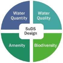
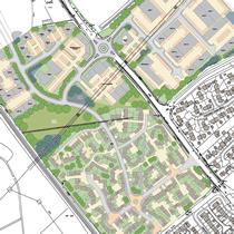 WHS has satisfied the runoff and treatment requirements in a large complex site with a combination of appropriate SuDS strategies. Biodiversity will be enhanced and local amenity enriched.
A proposed 20-hectare development of mixed commercial, industrial and
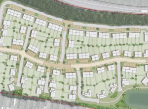 Flood map data for the flood zone of a minor watercourse in Nottinghamshire restricts the number of properties in a planned 87-unit housing development.
Flood map data used for planning purposes is sometimes based on coarse modelling techniques that can …
An 80-unit residential development is proposed for a factory site prone to groundwater-dominated river flooding in Wiltshire. Barriers to planning consent have left the client on the verge of dropping the development.
 Several years of modelling analysis and negotiation with …
The Huntingdon racecourse and hotel are on the floodplain of the Alconbury Brook and prone regular floods. Access to the site and facilities is jeopardised.
 A plan to raise the access road was strongly opposed by the Environment Agency (EA) …